3D Earth: How Lidar can improve accuracy in the field of GEO mapping
LiDAR (Light Detection and Ranging) is a sensing technology that uses laser pulses to measure distances and create highly accurate 3D maps of the Earth’s surface. It can be a valuable tool in GEO mapping (geographic mapping) for a variety of reasons:
1. Highly Accurate Data: LiDAR can provide extremely precise elevation data. By measuring the time it takes for laser pulses to bounce off the ground and return to the sensor, LiDAR can create detailed digital elevation models (DEMs) or digital surface models (DSMs). These elevation models are crucial for GEO mapping, especially in hilly or mountainous terrain.
2. Terrain Analysis: GEO mapping often involves analysing and understanding the Earth’s surface, including aspects like slope, aspect, and roughness. LiDAR data can be used to calculate these terrain characteristics accurately, aiding in various applications like soil erosion prediction, flood modelling, and land-use planning.
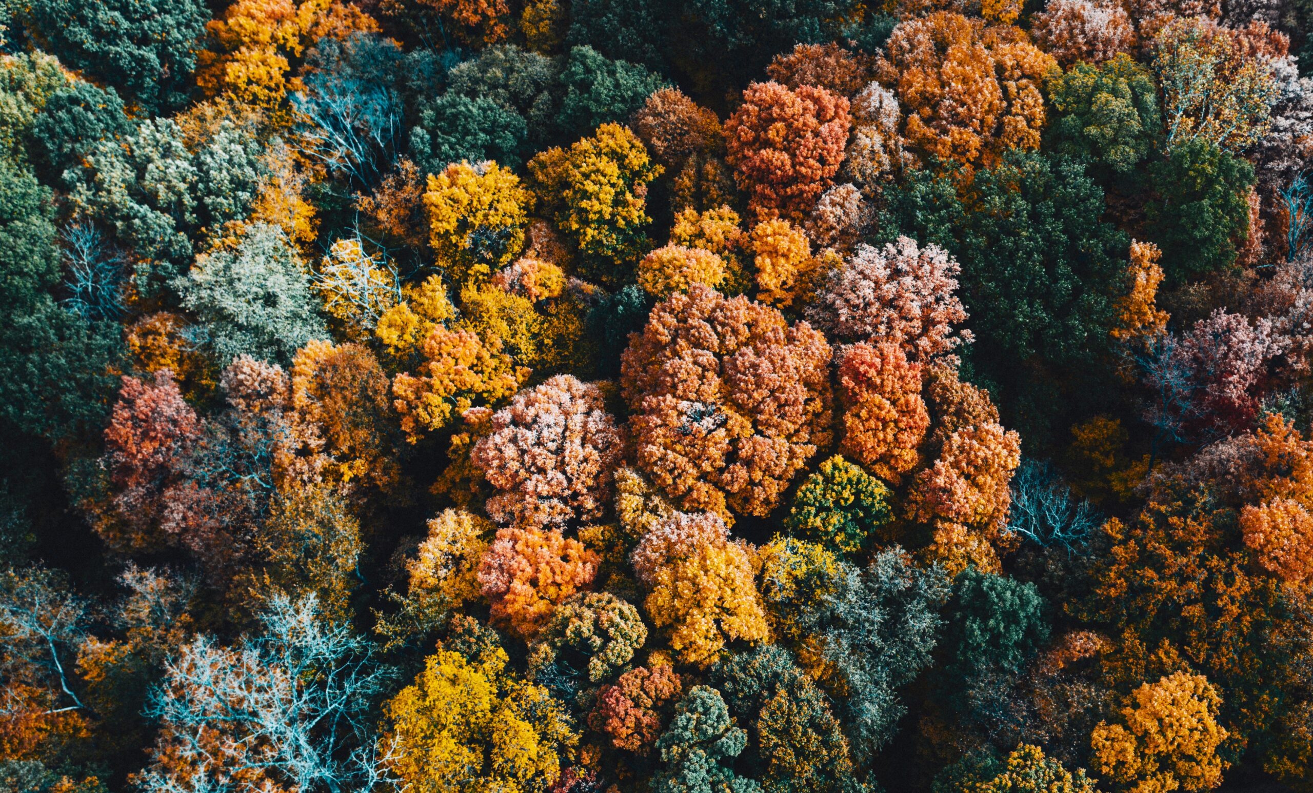
3. Vegetation Analysis: Use of multi-echo functionality and data analysis techniques facilitate the creation of highly accurate “bare earth” models that effectively remove vegetation cover. This can be valuable for mapping and monitoring changes in land cover, such as deforestation, urban expansion, or vegetation health.
4. Harvest Planning and robotic harvesting: Alternatively, LiDAR data can be used to create precise maps of orchards or fields, including the location of each fruit tree and the distribution of fruits. This data can then be analysed to optimize the harvesting route and schedule, ensuring that all fruits are picked efficiently and at the right time. In addition, LiDAR sensors can be integrated into robotic harvesting systems. These robots can autonomously navigate using LiDAR-generated maps and pick with precision. They can also avoid obstacles and adapt to changes in terrain, making them versatile and efficient in various agricultural settings.
5. Flood Modelling and Risk Assessment: LiDAR data can be used to map the topography of flood-prone areas and assess flood risks accurately. This information is essential for urban planning and disaster management.
6. Urban Planning: LiDAR can be used to create detailed 3D models of populated areas, including buildings, roads, and infrastructure. This is valuable for urban planning, transportation management, and disaster preparedness.
7. Forestry Management: LiDAR is used in forestry for measuring tree height, canopy density, and forest structure. This data is crucial for sustainable forestry management, timber harvesting, and carbon sequestration assessments.
8. Archaeological Site Detection: LiDAR can reveal archaeological features that are not visible from the surface, such as buried structures or ancient landscapes. This technology has been instrumental in discovering hidden archaeological sites and cultural heritage preservation.
9. Coastal and Marine Applications: LiDAR can also be used in coastal and marine GEO mapping to measure seafloor topography, shoreline changes, and coastal erosion. This information is valuable for coastal management and navigation.
10. Infrastructure Monitoring: LiDAR is used to inspect and monitor critical infrastructure like bridges, dams, and pipelines. It can detect structural deformations or damage that might not be visible through traditional methods.
11. Natural Hazard Assessment: LiDAR data can assist in assessing and monitoring potential natural phenomena, including landslides, avalanches, earthquakes, and volcanic eruptions, by providing detailed topographic information that can be used for hazard modelling and risk mitigation. Additionally, LiDAR’s can be used in known “hot spots” as an early warning alerts for impending catastrophic events.
It is clear LiDAR technology offers a range of benefits for GEO mapping by providing highly accurate and detailed 3D spatial data. This data can be applied to a wide range of fields, from environmental monitoring and urban planning to disaster management and archaeological research.
We currently have a variety of LiDAR scanners that could meet your needs in this area. You can find out more our full selection of LiDAR scanners here. And make sure to stay up to date with all our news, insights, and product developments by following us on LinkedIn and X.
Popular news

How does LiDAR compare to camera and RADAR technology?
Comparison of LiDAR (Light Detection and Ranging), Camera and RADAR (Radio Detection and Ranging) technology.
What is Art… and how can LiDAR technology be used to create it?
LiDAR has found new applications in interactive art installations, enabling impressive immersive experiences.
Get expert advice on which product is best for you:
Germany: +49 7824 70397-50
United Kingdom: +44 1666 660016
Get in touch